Walking trails around Central Alberta

Wednesday, March 15, 2023

March 16, 17, 18Notes on Chiricahua hike - Cancelled for this weekend. We will plan for March 31 - April 2nd.

We have decided to do the 8.14 mile hike on Saturday because we only have one group. We will do the Grotto on Sunday, as well as the Natural Bridge. 

This is our weekend hike at the end of the season. You need to sign up for this hike ahead of time and make arrangements for hotel and transportation ahead of time. 

Please let Nancy (me) know if you are interested at nanc21.na@gmail.com

The Chiricahua hike is at the Chiricahua National Monument. https://www.nps.gov/chir/index.htm 

Google Maps to all destinations.

Friday - March 17th. - Leave the Parking Lot at 8:00. Bring a lunch, just like you would on a regular hike. Cochise Stronghold /https://cochisestronghold.com/  This is a 7-mile hike out and back. 

Casa Grande to Cochise Stronghold is 148 miles (2 1/2 hours driving time). 

Arrival time: approx. 10:45.

Hiking time is approx. 3 hours and 45 minutes. 

Cochise Stronghold to Willcox is 32 miles (45 minutes).

Arrival time in Wilcox is approx. 3:30 - 4:00 pm. Check into Motel. 

We need to get sandwiches etc. for lunch and water at the nearby Safeway store.

There are several eating establishments in Willcox. We may all want to go together. It is our choice. 

Saturday - March 18th - Leave Motel 6 at 8:00 after Breakfast at McDonalds.

Drive from Willcox to Chiricahua National Monument to the Visitor Center. (We will leave one car at the bottom to take the drivers of the other cars back up to the top). Drive up East Bonita Canyon Road to the top parking lot to Massai Point.  

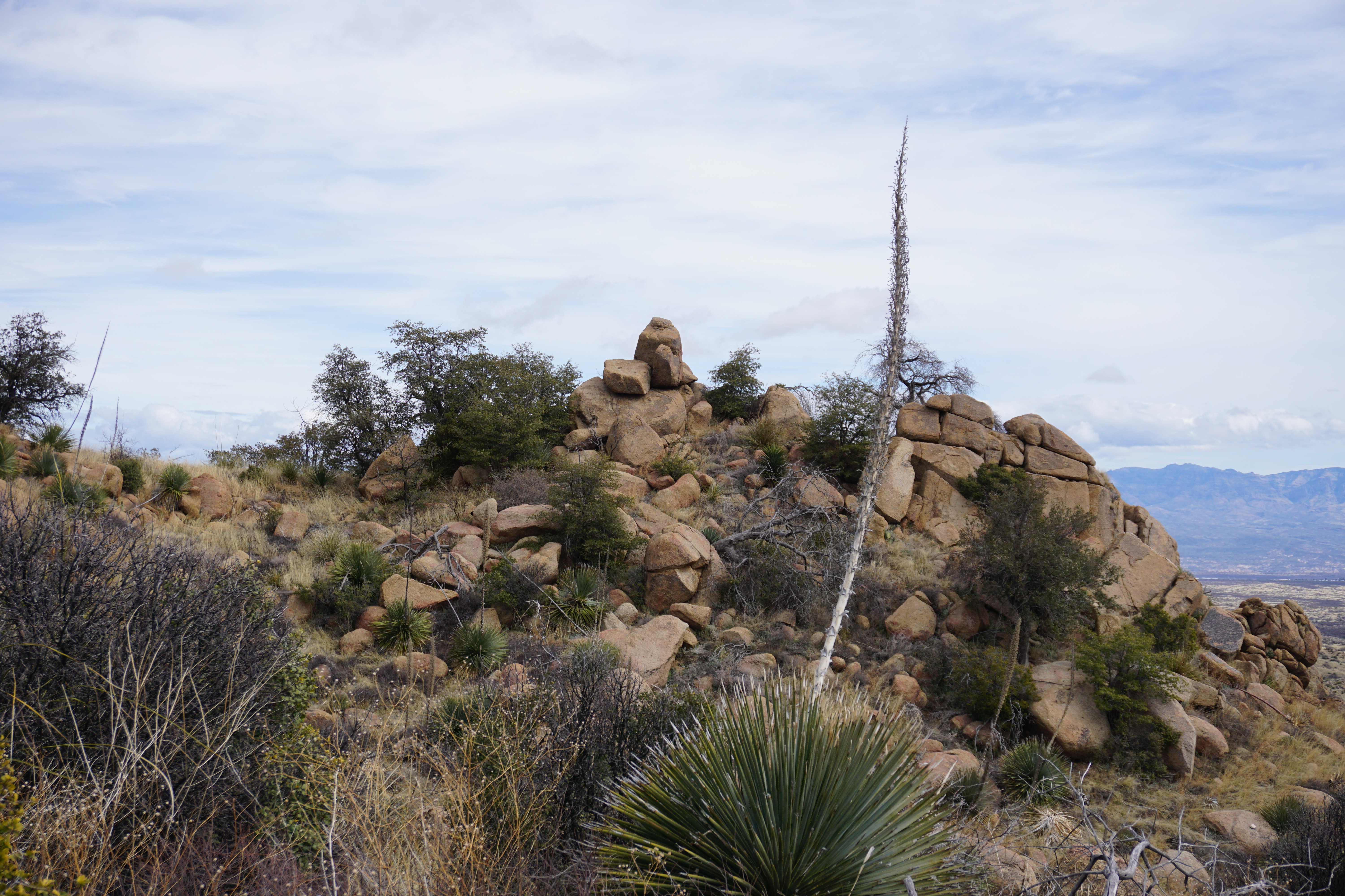
There is an option to hike 9.9 miles or hike 8.14 miles. 

9.9 mile hike starts at Massai Point Nature Trail. Then go straight onto Echo Canyon Trail. This takes you through the Grotto. Then go on the Hailstone trail (Not Upper Rhylite trail) to Mushroom trail. Along the way, we see a junction to Inspiration Point which is an out-and-back hike and a great place for lunch.  Once back at the junction, the trail turns into Big Balanced Rock Trail. Heart of the Rock Loop is off of this trail. Once back to the junction, this trail turns into Sara Deming Trail which meets the Lower Rhyolite Trail that takes us to the visitors center.

8.14 mile hike starts on the Massai Point Nature trail, then go left onto Ed Riggs Trail, then turn left onto Mushroom Rock Trail. (Do not take the Hailstone trail). Along the way, we see a junction to Inspiration Point which is an out-and-back hike and a great place for lunch.  Once back at the junction, the trail turns into Big Balanced Rock Trail. Heart of the Rock Loop is off of this trail. Once back to the junction, this trail turns into Sara Deming Trail which meets the Lower Rhyolite Trail that takes us to the visitors center.

Then the driver of the car left at the bottom takes the drivers of the cars left at the top and brings them down to the parking area at the visitor's center. 

Sunday - March 19- Leave Motel 6 at 8:00. Check out from the Motel. Breakfast at McDonald's. We have the option of doing one hike or two. 

Drive to the Visitors Center at the Chiricahua Visitor Center or go directly up East Bonita Canyon Road to the Sugarloaf parking area on top. This is an out-and-back hike that has views of the Chiricahua's from an old Fire Lookout station.  1.9 miles. 

Then drive 1/2 way down East Bonita Canyon Road to the Natural Bridge. This is a nice hike to a lookout where we can see a natural bridge. 4.7 miles. We drive home from here. 

We have nine hikers signed up with the possibility of three more for the Chihuahua weekend hike. 

We are leaving on Friday morning at 8:00 from the Parking Lot. The same as usual. Please prearrange a ride prior to the hike and book the motel. 

Accommodations: Motel 6. (this used to be the Best Western) -  69.95/night if you call directly at 520-766-3700. Address 1100 W. Rex Allen Dr. Willcox, AZ. Let them know you are with the Palm Creek Hiking Club, your room preference and number of nights you are staying. If you cannot get through to this number call 1-800-899-9841 and join for a discount. See website below. 

https://www.motel6.com/en/home/my6/join.html

There is no breakfast offered here.  The regular rate is $82.95 - $84.95, depending on the room requested. 

We can go to McDonald's or Carl Juniors for Breakfast before heading out to the Chiricahua National Monument. 


Saturday, March 11, 2023

March 8, 2023 Prehike to investigate water levels at Sabino Canyon

Nancy (me) and Larry went to Sabino Canyon to see how high the water levels were. 
The hiking group had purchased tickets to Crawler on the website. Sabino Canyon Crawler - for tickets.
Larry and I went on the "High Water Tour" on the Crawler that took us to Stop #2 then turned around. We viewed the water going over the bridge. Then we went to a viewpoint of the Dam, then went to the Dam. Larry and I walked back on the Sabino Lake Trail coming back and ended up at the Nature Trail by the Visitor Centre.
The volunteer at the park said the creek on phoneline was ankle deep so we could get across. (He didn't say we had to cross at the bridge). Another volunteer said that likely the crawler would remain closed on Friday because of the high amount of snow on Mt. Lemmon. 
I should have checked the water crossing for myself, but we decided to go the Mt. Lemmon instead. 
After calling John about the conditions, we decided to cancel the tickets. The Manager of the Crawler was very good about this and we all were able to get refunds. The tickets are $15.00 each. 


Saturday, February 11, 2023

February 20, 2023 Prehike to American Flag Trail

 Mike, Jerry and Nancy pre-hiked the American Flag Trail from the Trailhead located on Mount Lemmon Road to the ridge and then turned right on the Arizona Trail and hiked another 1/2 mile to another scenic view. American Flag Trail is in Oracle State Park. 


The first mile of the trail has burnt trees from a fire in 2021. The trail has been managed to accommodate horses and fix the damage from the fires. There is red sand and loose rock on portions of the beginning of the trail.
The trail takes us up where we can see wide vistas of the mountains to the east, then winds down into a wash. After one mile it starts to climb again and has switchbacks across a grassy area with large boulders.


 We keep following the trail up and it takes us to High Jinks, a place where Buffalo Bill Cody once had a mine. This has been purchased by the country and now is privately owned. The property around it is designated as a National Historica Site. There are old stone structures and a wagon filled with antiques. A mailbox still stands on the property above an old swimming pool. 

There is a gate to Oak Creek Ranch, that may have been used for a Boy Scout Camp in the past. It can be viewed once we hike further up the trail. 


Oak Creek Ranch


We stopped to have lunch. Lots of rocks to sit on, but not much of a view.  

                                                
We hiked about 1/2 hour past our spot for lunch to the ridge. It is an uphill climb. It was 3.6 miles to this spot. The medium group would have a 7.2 mile out and back hike. There is a view of Picacho Peak and the Biosphere 2. This hike has an elevation gain of 1293 feet in 3.6 miles. 


A picture of Jerry and Mike up the Arizona Trail after we turned right.
                                                                              
The viewpoint looking back at Oracle. 

The hike to the view point is 4 miles. The long hikers would have an 8 mile out and back hike. 
The hike down was like a leisure walk down a nice trail. There were a few spots where the trail needs to be fixed (holes where horses could break their legs). We saw two horses and met a few other hikers along the trail. 


We looked at the trail on the other side of the road. 

Apparently this trail goes to an old ranch with a windmill. It is flatter than the American Flag Trail. It may be able to be used for an early hike when we don't want so much elevation gain. 
                 
Directions: Take I-10 east to exit 219 (Picacho Peak) and turn left under the freeway. Turn Right onto the frontage road, Camino Adelante, at the stop sign before the train tracks. Follow the Camino Adelante for about four miles. Turn Left on Park Link Drive and drive 18 miles. Turn right on Highway 79. Go 10.3 miles then turn left onto Highway 77. Go about 10 miles and turn right onto American Avenue. Proceed through the town of Oracle until you come to Mount Lemmon Road and turn right. (There is no advance warning for the turnoff but there is a green sign right at the turnoff.) Follow the road for about four miles to American Flag Ranch road, and turn right at the street sign for American Flag Ranch Road. Drive until you see a wooden archway with a sign and a parking lot on each side of the road. Park on the right side of the road. No facilities at the trailhead.