 |
| Start of Old King Canyon Trail |
 |
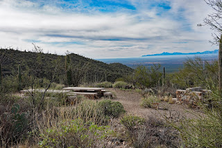
| View from Old King Canyon Trail |
 |
| The Old King Canyon Trail |
 |
| View of the Old King Canyon Trail from King Canyon Trail |
 |
| At the junction of the King Canyon Trail and the King Canyon Wash. Both go to the Trailhead. |
 |
| Looking Down onto the King Canyon Wash |
 |
| The King Canyon Trailhead sign |
 |
Back to the Parking Lot - Time 1:40 -
About 4 hours and 6.8 Miles |
Hike Description -
Medium Hike from the King Canyon Trailhead: Gould Mine - Sendero Esperanza - King Canyon to Sweetwater Saddle.
Long Hike: From the King Canyon Trailhead to Wassen Peak
Since this is a National Park each car should have an American Golden Passport Card.
Directions, distance and time to the trailhead:
From Florence Blvd, take I-10 south to exit 236. Turn right and then a quick right onto Marana Road. Drive one mile and turn left onto North Sanders Road, drive four miles. At the stop sign turn left onto Avra Valley Road. Drive one mile and turn right onto Sandero Road. Proceed 9 miles and turn left at the entrance to the park, onto Kinney Road. Drive 2.4 miles to the Red Hills Visitor Center for a pit stop. Coming out of the Visitor Center turn left onto Kinney road then turn left at the dead-end (W.Mile Road Sign). Drive along Kinney road for about 2 miles, there is a sharp left into the Trailhead parking lot, no road sign not paved. The Desert Museum sign is in view, but you do not want to go that far.


 Lo
Lo


No comments:
Post a Comment