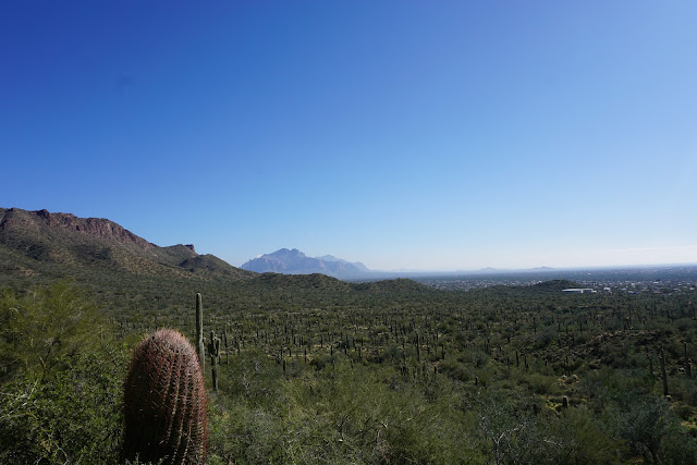
Montey, John and Nancy pre-hiked Pass Mountain Trail. We started from the Wind Cave Trailhead and immediately turned left at the Pass Mountain trail sign. The trail is very gentle at the beginning of the hike. We walked down into a wash right away and back up where we and followed along a picturesque desert landscape. It was very green because of the rain. Ocotillo plants were in leaf. The trail went through several more washes before starting to climb. We came to a gate that was labelled Maricopa Trail. We continued on a very well-groomed trail where we could hike easily. As we rounded the mountain, we could see a panoramic view of the Goldfield Mountains. We could see Salt River Canyon Bridge and the valley were Saguaro Lake is and a trail we sometimes hike called Butcher Jones Trail. We couldn't see the lake from there. Looking back we could see Fountain Hills. There was also a mountain peak called Four Peaks that is also the name of the Wilderness Area for the Tonto National Forest.
The trail began to get more rugged with loose rocks as we proceeded upward to the other side of the mountain until we came to a saddle between the mountain beside us and Pass Mountain. We walked along the face of the mountain beside us along a ridge of welded tuft rock. People were having their lunch and taking in the view of the valley. We walked past them and started switchbacks down on where the trail is less easy to navigate with flat rock in some areas and loose rock in others, but still manageable. There was an area with some very large rocks and many small rocks that provided a good place to have lunch. It was 11:30 and we had gone about 4.3 miles. We left our lunch spot at 12:00 and wound our way down the mountain to the edge of a wash and buildings. We turned west and walked on loose rock, winding down into several washes until we arrived at a sign showing our way back to the trailhead. We arrived at the trailhead at 2:50. 7.9 miles. This hike was rated by us at a C+ in difficulty.
 |
| We had lunch here |


No comments:
Post a Comment