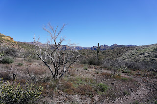
John and I (Nancy) prehiked the Black Mesa Trail. We noticed that the trail in was very rough and cars without clearance may not be able to make it to the trailhead. Most of the cars that were in the parking lot had good clearance.
There are two bathrooms and plenty of parking.
We started on the Lost Dutchman Trail #104 and soon came to a stream of water which was easy to cross. At the junction of Lost Dutchman and Second Water, we went straight to Second Water Trail. This tail takes you to Black Mesa and Hackberry Springs Trail.
The trail is fairly rocky. We walked along a ridge trail along a mountain for short while, then walked down into a few rocky washes. We hiked up out of this area where there are beautiful landscapes and rocky structures. This brought us to a flat area. We met up with a group of young backpackers who had camped overnight in this flat area.
As we hiked further on this flat area, we met up with a group riding horses. They were headed to Black Mesa as well. At the sign we turned right to Black Mesa. The rocky trail heads mostly up to a viewpoint on the other side. Here we can see Weaver's Needle and the Mountains between. At the top it is 3 miles and a good place for lunch for the medium group. There is a group of black rocks, great for sitting on. If we walk a little farther after lunch, we come across an old campfire pit. This has a better view of the Mountains. 3.2 miles. From here the medium group could head back for an out-and-back hike.
The long group could continue and walk down into the valley. They get more of a view of the mountains, but the trail is not pretty. There are burned trees along the way. We had lunch at a nice viewpoint. We turned back for an out-and-back hike, but the view going through the valley was bleak as we could not see any scenery ahead of us. Once we got back to the top of the mountain, where the medium group could have lunch, the scenery ahead of us improved as we could look back onto the mountains below and toward Hackberry springs rocks.
We turned left at the Black Mesa sign to go back to the Dutchman trail and back to the trailhead.
We started out on Lost Dutchman Trail 104. At the sign, junction of Lost Dutchman and Second Water, we went straight onto Second Water.

This is the place where we could go to Hackberry trail, straight ahead then off to the left.
 |
| Turning up Black Mesa |
 |
| HDR of Weaver's needle. |
 |
| John went on top of the rocks to see if he could see more of a view |
 |
| This is where the short hike could stop for lunch. 3 miles in. |
As we walked further we were able to get a better view of the landscape.
We hiked down into a valley, burned trees. Then up to see a bit more of the bluff in front of us.
 |
| Where we had lunch - about 4 miles in |
 |
| On our way back - I turned around to get this picture. The hike is a little bleak walking out of the valley because there was no scenery in front of us. |
 |
| I turned around to get this shot |
 |
| On our way back. |


No comments:
Post a Comment